
Envira Amazonia - Brazil
The Envira Amazonia REDD+ project is located in the state of Acre, Brazil, and aims to protect up to 200,000 hectares of tropical rainforest.
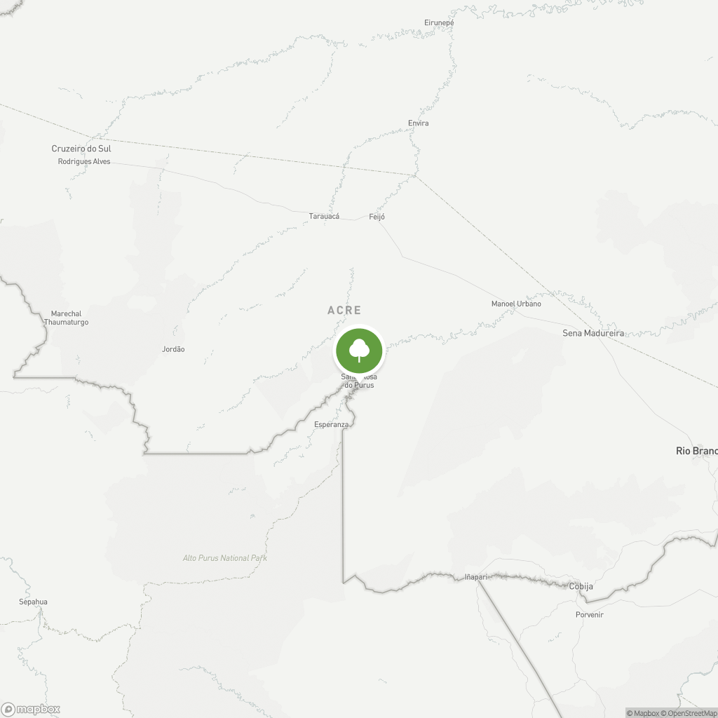

Around 60 km southeast of Feijó town in the Brazilian state of Acre, the Envira Amazonia project runs along either side of the Jurupari river in the Amazon Basin. It takes roots on 200,000 hectares of land formerly owned by businessmen and sold in 2009 to forest management experts. The Envira Amazonia Property was historically used for rubber tapping and was an extractive area for natural forest products before these activities stopped due to the crash in rubber prices in the late 1980s. The paving of the main east-west highway in Acre in 2011 has greatly increased property values, and cattle ranching along this road corridor has thus expanded.
The Envira Amazonia REDD+ (Avoiding Unplanned Deforestation and/or Degradation) project will generate carbon emission reductions by foregoing forest conversion to grassland in favor of the conservation of tropical forests and the preservation of existing carbon stocks. A baseline scenario was designed to estimate the volume of carbon emissions avoided by the project over 30 years. This was developed using a methodology approved by the Verified Carbon Standard program and based on the local deforestation context. Overall, the project will contribute to preserving the wide range of critical ecosystem services provided by the Amazon Rainforest. The project will also mitigate deforestation pressures in the wider region using a combination of environmental and social programs intended to improve the livelihoods of community members. Several agricultural awareness-raising sessions will be held, such as: alternatives to the use of fire in land preparation; improved pasture management, extraction and processing of medicinal plants for commercial purposes, production of açai and raising chickens.