MONITORING & ADVISORY PROGRAM
Measure the impact of your value chain on natural ecosystems and assess deforestation risk. Monitor, manage, and anticipate the environmental performance of your supply chains through a structured monitoring and advisory approach.


You want to measure and manage the real impact of your supply chains. If your business depends on natural resources, you need reliable data to assess ecosystem impacts, demonstrate deforestation-free sourcing (EUDR), and design regenerative projects that are both effective and economically viable.
When projects are already in place, the challenge remains: measure, monitor, and communicate impact to stakeholders, while aligning with key frameworks (CSRD, SBTi FLAG, SBTN) and integrating results into your sustainability reporting.
Turn data into action
Rely on a structured program combining diagnosis, monitoring, and advisory support to assess risks, manage environmental performance, and strengthen the long-term resilience of your value chains.
OUR SOLUTION
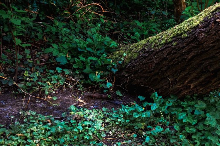
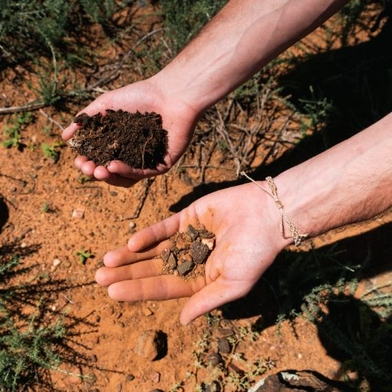
Our « Monitoring & Advisory » program enables you to assess existing projects or evaluate risks across conventional supply chains before transitioning to regenerative models. For ongoing projects, our experts analyse forest, agricultural, and production dynamics, assess project design, and define a monitoring plan combining field data and remote sensing—while supporting long-term optimisation and durability. Where no project is in place, the program enables you to assess deforestation and climate risks across your priority sourcing areas.
Why does our program simplify your reporting? Because all data is centralised and leveraged within an MRV platform, enabling impact management, informed decision-making, and seamless integration into regulatory and internal reporting frameworks.
The EU Deforestation Regulation (EUDR), in force since June 2023, requires companies to demonstrate that their sourcing carries no or negligible risk of deforestation. It notably requires precise plot geolocation and the ability to prove that key commodities, such as coffee, cocoa, palm oil, and soy, are not linked to deforestation or forest degradation.
Reforest’Action tools to support you
Are you impacted by EUDR? Our satellite-based land cover analysis tools enable you to assess and monitor deforestation risk across your sourcing areas. They provide a dynamic view of land-use change, help identify high-risk zones, and deliver data that can be directly used for regulatory compliance.
The SBTi FLAG (Forestry, Land and Agriculture) framework enables companies with land-intensive activities to integrate land-use emissions and carbon sequestration into their climate strategies. It provides a structured approach to measure, manage, and set targets for both emissions reduction and carbon removal across the value chain.
Reforest’Action tools to support you
Are you aligned with SBTi FLAG? We use remote sensing tools to measure and map carbon storage in tree cover within agroforestry systems. By analysing biomass across agricultural landscapes, we quantify carbon sequestration, track its evolution over time, and identify areas with strong improvement potential.
Measure and manage existing regenerative models
with long-term monitoring of agroforestry initiatives and analysis of their real impact
Anticipate EUDR compliance
through plot geolocation, risk assessment, and prioritisation of actions ahead of regulatory deadlines
Assess conventional supply chains
through a baseline (T0) diagnosis to identify key risks and sustainability levers
OUR EXPERTISE
What sets us apart
A hybrid monitoring approach: We combine the accuracy of field data, used as a ground-truth reference, with satellite analysis to extend coverage and increase monitoring frequency.
An MRV platform designed for business needs: We have developed an in-house platform to support data visualisation, transparency, and reporting, with 25+ digital, actionable indicators.
A regulatory-ready approach: We design monitoring frameworks aligned with current and upcoming requirements, ensuring relevant indicators for your reporting needs.
They say it better than we do
The transformation of our cotton sourcing model will therefore be monitored over time through impact indicators related to water and soil.
The regenerative cotton project we are implementing in India is a concrete application of our Vision 2035 and of the sustainability pillars for which we have set quantified targets.
The transformation of our cotton sourcing model will therefore be monitored over time through impact indicators related to water and soil, defined jointly with Reforest’Action.
In addition, the integration of sustainable agricultural practices offers an opportunity to store carbon within our value chain. This aspect will be closely monitored, particularly as part of our SBTi FLAG pathway, on which we have undertaken in-depth reflection.
Read: News, insights and perspectives from the field

Carole Renner: “Facilitate the evaluation of climate impact and continuously improve the design of our projects”

Measuring the impact of NbS projects: launch of our MRV platform